


Data Quality86%
MASS(Military Archive Scoring System)
ⓘ Regardless of era, the same scoring system applies to all units in the optical / imaging satellites category.
01 / Overview
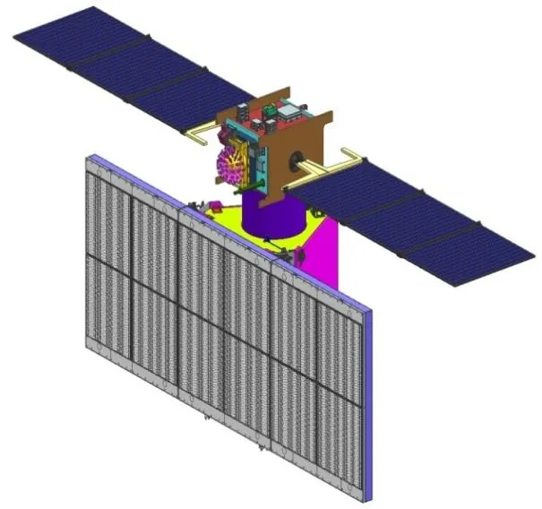
Radar Imaging Satellite
Category
Country
Prime contractor
Production
2009–
Quantity
6
Unit Price (current)
$300.1M↗ 50% inflation · 2009→2025
Original Price
$200.0M (2009)
Operators
💰 PERFORMANCE / PRICE ASSESSMENT Methodology ↗
OPTICAL / IMAGING SATELLITES · POST-COLD WAR
1
PERFORMANCE/PRICE
87
UNIT COST (2025 USD)
$300.1M
Original: $200.0M (2009)
Inflation: +%50
ⓘ Performance/Price and MASS score are computed across all units in the optical / imaging satellites category, regardless of era.
02 / Specs & Design
◎General6MOD.6
- Satellite Typeradar imaging reconnaissance satellite
- First Launch Year2009
- OperatorISRO
- Constellation Size6
- ManufacturerISRO
- In ServiceYes
◈Orbit5MOD.5
- Orbit Type (LEO/MEO/GEO)Sun-synchronous orbit
- Altitude548 km
- Inclination41
- Orbital Period90
- Design Life5 year
▣Platform3MOD.3
- Launch Mass300 kg
- Power750 kW
- Satellite BusOptSat-2000
◇Payload5MOD.5
- Primary PayloadSynthetic Aperture Radar
- Imaging Resolution1 m
- Sensor TypeX-band SAR
- Inter-Satellite LinkNo
- Frequency BandX-band
◆Program2MOD.2
- Number Launched6
- First Launch2009
03 / History
SERVICE LIFESPANStill in Service
- 2009Production started
- 2012Entered service
17
years in service
6
units produced
11
countries operating
ⓘ The producing country still actively operates it.
04 / Operators
Operator Countries11country


05 / MASS Score
OPTICAL / IMAGING SATELLITES RANKING Optical / Imaging Satellites · Post-Cold War


MASS RANKINGSMASS ↗
7OPTICAL / IMAGING SATELLITES1POST-COLD WAR · OPTICAL / IMAGING SATELLITES59INDIA · ALL WEAPONS1PRICE · OPTICAL / IMAGING SATELLITES118PRICE · ALL WEAPONS3PERFORMANCE/PRICE · OPTICAL / IMAGING SATELLITES
ⓘ Rankings are within theOptical / Imaging Satellitescategory.
📚 Sources