


Data Quality84%
MASS(Military Archive Scoring System)
ⓘ Regardless of era, the same scoring system applies to all units in the reconnaissance / surveillance drones category.
01 / Overview
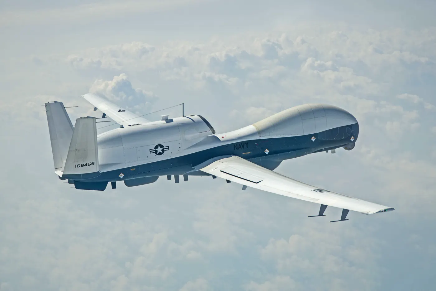
Northrop Grumman MQ-4C Triton
Country
Prime contractor
Production
2018–
Quantity
68
Unit Price (current)
$128.2M↗ 28% inflation · 2018→2025
Original Price
$100.0M (2018)
Operators
💰 PERFORMANCE / PRICE ASSESSMENT Methodology ↗
RECONNAISSANCE / SURVEILLANCE DRONES · MODERN ERA
4
PERFORMANCE/PRICE
58
UNIT COST (2025 USD)
$128.2M
Original: $100.0M (2018)
Inflation: +%28
ⓘ Performance/Price and MASS score are computed across all units in the reconnaissance / surveillance drones category, regardless of era.
02 / Specs & Design
◎General6MOD.6
- UAV ClassHALE
- Category (MALE/HALE/Tactical/Micro)Reconnaissance / Surveillance Drones
- First Flight2013
- Service Entry Year2018
- Primary RoleMaritime surveillance
- In ServiceYes
◈Airframe6MOD.6
- Length14.508 m
- Wingspan39.898 m
- Height4.6 m
- Empty Weight6,779.052 kg
- Max Takeoff Weight14,630 kg
- Low ObservableNo
▣Powerplant5MOD.5
- Engine TypeRolls-Royce AE 3007
- Number of Engines1
- Engine Power3,700 kW
- Electric PropulsionNo
- Propeller / ConfigurationNone
◇Performance6MOD.6
- Top Speed575 km/h
- Cruise Speed500 km/h
- Service Ceiling17,000 m
- Range15,200 km
- Endurance30
- Maximum Payload1,000 kg
◆Payload & Sensors6MOD.6
- EO/IR SensorYes
- SAR / GMTI RadarYes
- SIGINT PayloadYes
- Laser DesignatorNo
- Sensor Payload Weight1,000 kg
- Comms RelayYes
▤Armament4MOD.4
- ArmedNo
- Hardpoints0
- Weapons Payload0 kg
- Air-to-Ground MissilesNo
⬢Control & Autonomy5MOD.5
- Control TypeRemote/Autonomous
- Satellite (BLOS) LinkYes
- Autonomous CapableYes
- Swarming CapableNo
- Automatic Takeoff/LandingYes
▲Production4MOD.4
- Total Built48
- Unit Cost100,000,000 USD
- Operators2
- Variants1
◎Service History2MOD.2
- Production Start2013
- Operational StatusLimited service
03 / History
SERVICE LIFESPANStill in Service
- 2018Production started
- 2026First deployment: 2026 Iran War
8
years in service
68
units produced
3
countries operating
ⓘ The producing country still actively operates it.
04 / Operators


Northrop Grumman MQ-4C TritonSALES1records
| Year | Buyer | Quantity | Amount | Present Value (2025) |
|---|---|---|---|---|
| — |  Australia | 4 | — | — |
ⓘ "Present Value" is an estimated amount adjusted for inflation.
05 / MASS Score
RECONNAISSANCE / SURVEILLANCE DRONES RANKING Reconnaissance / Surveillance Drones · Modern Era

MASS RANKINGSMASS ↗
12RECONNAISSANCE / SURVEILLANCE DRONES4MODERN ERA · RECONNAISSANCE / SURVEILLANCE DRONES303UNITED STATES · ALL WEAPONS1PRICE · RECONNAISSANCE / SURVEILLANCE DRONES162PRICE · ALL WEAPONS236PERFORMANCE/PRICE · RECONNAISSANCE / SURVEILLANCE DRONES
ⓘ Rankings are within theReconnaissance / Surveillance Dronescategory.
📖 TERMS ON THIS PAGE7terms
Automatic Takeoff/Landing is a UAV capability that enables a drone to initiate and complete takeoff and landing sequences autonomously using onboard sensors and control software.
Capable of performing tasks or missions without direct human control, using onboard systems to make decisions and execute actions.
A capability enabling drones to relay communication signals between units, extending operational range and maintaining network connectivity in combat environments.
Electro-optical/infrared sensor combining daylight cameras and thermal imagers for real-time target detection, tracking, and identification in military drones.
Synthetic Aperture Radar (SAR) and Ground Moving Target Indicator (GMTI) radar are airborne radar systems used to detect, track, and image moving or stationary targets on the ground, regardless of weather or lighting conditions.
A communication link between a drone and its control station via satellite relay, enabling beyond-line-of-sight (BLOS) operations.
These terms are listed automatically because they appear on this page.full encyclopedia →
📚 Sources